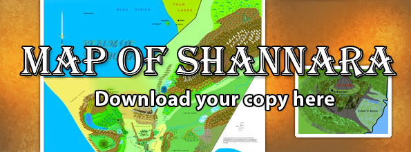
Travelling information from the book.
| PAGE | SUBJECT | DRUID – 2 Late Summer (p160) | Mileage |
| 69 | Battlemounds | Hill country below Battlemounds , 2 days on horse to Southwatch. | 120 |
| 123 | Hearthstone | 3 days + 2 nights on foot from Culhaven to Hearthstone via Pass of Jade | |
| 133 | Eldwist | Is far north and East above Charnal mts, where the eastland ends at the Tiderace. | |
| 160 | Toffer Ridge | From Hearthstone travel north along Toffer ridge and across Rabb river. | |
| 162 | Upper Anar | One week on foot going north above upper Anar to foothills of Charnals. | |
| Several passes through mts all beginning at Rampling Steep. | |||
| 163 | Charnals | Journey NE on road for 13 days and reach junction. Winding road leading West into foothills. | 260 |
| Follow road west for 8 hrs. | 15 | ||
| 165 | Charnals | Head NE on road to base of mts. A further 12 hrs to Rampling Steep. Mts to west. | |
| 183 | Charnals | Take road along foothills. Change to mts after a few days. Slow progress (1 mph?) | 20 |
| 184 | Charnals | Snow capped mts. | |
| 185 | Charnals | 10 days out start descent, + 4 days mountains thin, + 1 day arrive at valley | |
| Spikes | Valley 10 ml long running N/S. Funnel shaped, widest at south, with ridgeline down middle. | ||
| 214 | Charnals | Northern edge of mts 20mls from north edge of valley. | |
| 218 | Charnals | Forested hills to north of Charnals. Rabb running west then turning east. | |
| 221 | Rabb river | Emerges out of rocks and broadens into hill country. Pools in forested basin NE of where river emerges from mts. | |
| River flows south out of basin. | |||
| 230 | North land | travel north away from Charnals into forest. | |
| 231 | North land | walk for 5 days. Country full of rivers and lakes. | |
| 232 | North land | on day 6 land becomes grey. | |
| 233 | North land | On day 7 1/2 land turned to stone. At sunset arrive at Tiderace penninsular. | |
| 307 | Irrybus mts | 5 days to cross Irrybus on foot. | 50 |
